Subject: World
Period: 1705 (circa)
Publication: Atlas Novus
Color: Hand Color
Size:
7.4 x 3.9 inches
18.8 x 9.9 cm
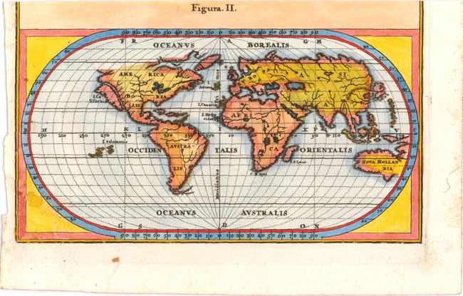
This little map of the world shows b>California as an island. There is very little inland detail except for the large lakes and seas and the river systems. The Solomon Islands occupy the Pacific and most of the Australian coastline is shown, here labeled Nova Hollandia. This map is the lower half of a sheet with a world map on Mercator's projection above it, titled Mappa Geographica Universalis in Plano et Figura Quadrata. Heinrich Scherer, professor of mathematics at Munich, was a devout Jesuit whose work emphasizes the Catholic hierarchy and the spread of Jesuit missions throughout the world.
References:
Condition: B
There are a few faint spots in the image. Trimmed at top, with title missing.