Subject: Colonial Mid-Atlantic
Period: 1757 (circa)
Publication: Prevost's Histoire Generale des Voyages
Color: Hand Color
Size:
11.5 x 7.5 inches
29.2 x 19.1 cm
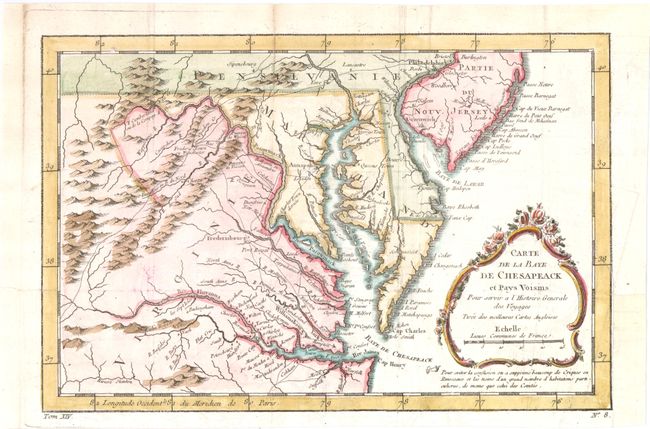
Finely engraved colonial map covering most of Virginia, Maryland, Delaware with a bit of Pennsylvania and New Jersey. The interior is fully engraved with mountains and great detail along the rivers. An early network of trails and wagon roads are delineated, plus watershed and some topographical information. It extends west to beyond Fort Cumberland and locates Annapolis, Fredericksburg, Williamsburg, Norfolk, and Philadelphia. The delicate rococo-style title cartouche incorporates the distance scale.
References: Sellers & Van Ee #1383; cf. Tooley (MCC 96) #875.
Condition: B+
Issued folding, now pressed on watermarked paper with light offsetting and a tiny hole in border at top left. A binding trim at bottom right has been repaired with old paper, and an adjacent binding tear that just enters map border has been archivally repaired. Two fold separations and a short tear in top blank margin have all been professionally repaired.