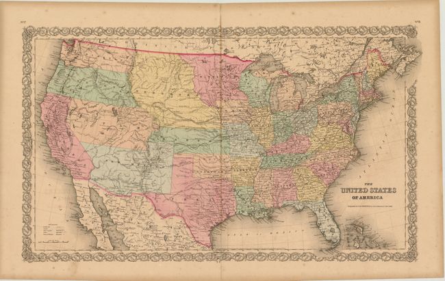
Subject: United States
Period: 1855 (dated)
Publication:
Color: Hand Color
Size:
25.5 x 15.8 inches
64.8 x 40.1 cm
A great map of the United States with early western territorial boundaries. There is no sign of Dakota as Minnesota extends to Nebraska at the Missouri River. The huge Nebraska Territory stretches between Minnesota to Oregon and Washington Territories at the Continental Divide, and south to Kansas. The large Kanzas Territory borders Utah and New Mexico in the west as there is no Colorado. Utah and New Mexico are both shown in their largest configurations. The map is filled with details and place names, forts, Indian tribes, emigrant roads and much more. Several exploration routes are shown, including those of Fremont, Marcy, and Kearney. Dated 1855, but it most likely was published in 1858 or 59.
References:
Condition: B+
Lightly toned with darker toning along centerfold, light offsetting and some tiny spots of foxing.