Subject: Africa
Period: 1708 (dated)
Publication:
Color: Hand Color
Size:
22.2 x 17.5 inches
56.4 x 44.5 cm
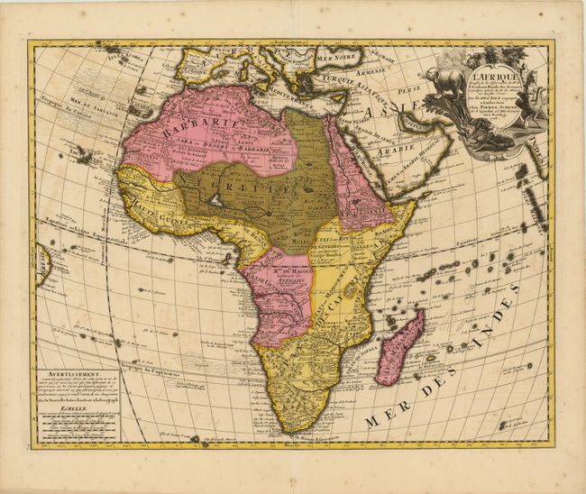
This striking map is one of the landmarks in the history of charting Africa. It was first issued by Delisle in 1700 and is distinguished by his scientific approach to cartography. Most of the maps of Africa issued in the eighteenth century were based on this map or his revision in 1722. The Nile is correctly shown with its origins in Abyssinia, and there is no line connecting the Niger and Nile Rivers. The Senegal River is also shown more correctly, originating in West Africa and flowing west into the Atlantic. The Congo or River Zaire, R. du Saint Esprit and the Zambeze appear in the south, along with the Portuguese settlements of Sean, Tete and Chicora. Several native kingdoms are named, as well as the sites of various mining districts. The title cartouche is beautifully decorated with three elephants, an ostrich and a native wrestling a crocodile.
References: Betz #174; Norwich #59.
Condition: B+
Bold original color with a few minute cracks due to the oxidation of green pigment, which have been closed on verso with Japanese tissue. There is faint offsetting and a few unobtrusive spots. There are short centerfold separations at top and bottom, far from map image.