Catalog Archive
Auction 140, Lot 365

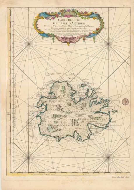
"Carte Reduite de l'Isle d'Antigue Dressee au Depost des Cartes Plans et Journaux de la Marine pour le Service des Vaisseaux du Roy", Bellin, Jacques Nicolas
Subject: Antigua

Period: 1758 (dated)

Publication:

Color: Hand Color

Size:
16.5 x 22.3 inches
41.9 x 56.6 cm
Download High Resolution Image
(or just click on image to launch the Zoom viewer)

Fine, large-scale map of Antigua provides detailed information on the roads, topography, parishes, towns, settlements, soundings and anchorages. It is decorated with a large, floral-garland draped title cartouche and rhumb lines. Seal of the Depot de la Marine in map and Prix. Dix huit Sols at bottom right.

References: Tooley (MCC-55) #29.

Condition: B+

Printed on sturdy paper with light soiling and some archivally repaired tears in blank margins, a few of which just enter neatline.

Estimate: $600 - $700

Unsold

Closed on 5/23/2012

Archived