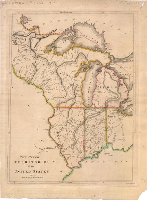
Subject: Central United States
Period: 1814 (circa)
Publication: General Atlas…
Color: Hand Color
Size:
12.5 x 17 inches
31.8 x 43.2 cm
This early American map focuses on what was then the western frontier. It shows the new territories that had been created from the original Northwestern Territory of the River Ohio - Ohio, Michigan, Indiana, Illinois and the remainder of Northwest Territory (Wisconsin and Minnesota). It shows Chicago in the Northwestern Territory, as the northern Illinois border is shown south of the present-day boundary without touching Lake Michigan. The spurious Phillipeaux Island still persists in Lake Superior. There is excellent detail of the Mississippi River and above to the Lake of the Woods. Detroit is shown with its Canadian neighbor, Windsor, named Sandwich. Numerous frontier forts and Indian villages are located, but much of the territory still appears unsettled. The apocryphal mountain ridges are the most prominent topography on the map. Engraved by Kneass & Delleker.
References: Karpinski, p. 215, #27; Phillips (Atlases) #722-25.
Condition: B
Original outline color on watermarked paper with light toning, a few tiny spots, and a small chip in bottom-left corner. There is a short tear that just enters map border at left, and one just outside of neatline at top left, that have both been closed on verso with archival tape.