Subject: Mid-Atlantic United States
Period: 1862 (dated)
Publication:
Color: Black & White
Size:
32.8 x 28 inches
83.3 x 71.1 cm
The Office of Coast Survey is the oldest U.S. scientific organization, dating from 1807 when Congress directed that a "survey of the coast" be carried out. By 1836, it was called the U.S. Coast Survey and in 1878, the name was changed to the U.S. Coast and Geodetic Survey. Today the Office of Coast Survey is a division of the National Oceanic and Atmospheric Administration NOAA.
The survey teams, composed of civilians as well as Army and Naval officers, charted the nation's waterways and produced a wide array of reports, survey charts, hydrographic studies of tides and currents, astronomical studies and observations, and coastal pilots. These charts are an important record of the changing nature of the nation's coastlines. In additional to coastal charts, the U.S. Coast and Geodetic Survey produced land sketches, Civil War battle maps, and the early aeronautical charts.
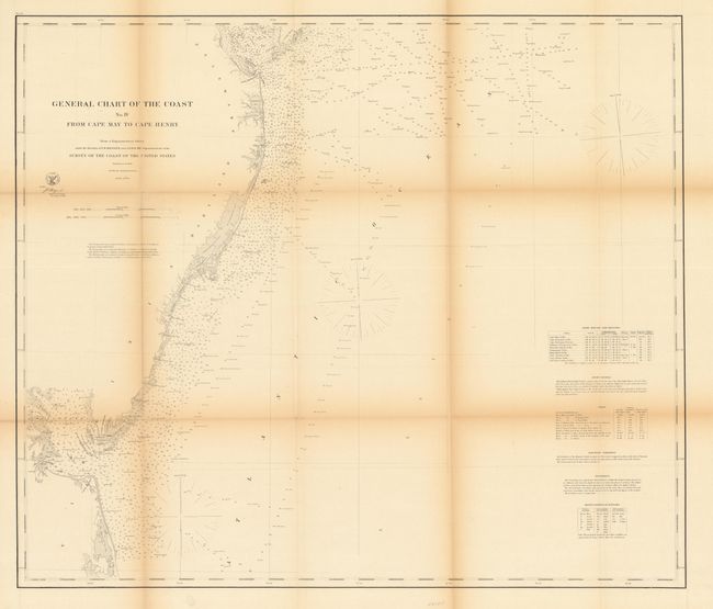
This sea chart extends from Cape May and Cape Henlopen at the mouth of the Delaware Bay to Cape Charles and Cape Henry at the mouth of the Chesapeake Bay. Portions of both bays are shown. There are numerous soundings and nice detail of the coast. On the right are tables displaying information on lighthouses and tides. Surveyed under the direction of A. D. Bache.
References:
Condition: B
Some toning at the folds and a few tiny separations at fold intersections that have been repaired with archival tape.