Subject: Reference Books
Period: 1961-96 (published)
Publication:
Color: Black & White
A.Early American Maps and Views, by The Philip H. & A. S. Rosenbach Foundation, published 1972 (8" x 5.8"). This booklet contains images and description to over 50 rare and important maps of American history from the Rosenbach Foundation collections. Bound in white, illustrated paper covers. Condition: Text is very clean, and covers are lightly soiled. (A)
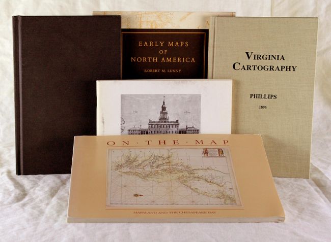
B.Maps and Views of Washington and District of Columbia, by P. Lee Phillips, F.R.G.S., from Terra Nova Press, published 1996 (6.3" x 9.3"). Phillips' list of maps and views from the collection in the Library of Congress is still important and useful despite being originally created over 100 years ago. It was a cartographical as well as a bibliographical report. The slim volume contains information on maps and views from 1782 to 1900. This reprint, edited by Francis J. Manasek, was only slightly modified by making grammatical corrections to the text from the original. An excellent reference for Washington, D.C. enthusiasts. 8vo. Original hardbound in black cloth with gilt title on spine. Condition: No visible wear inside or out. (A)
C. Virginia Cartography, by Phillips, reprinted by Arbor Libri Press, published 1995 (6.3" x 9.3"). This is a reprint of Phillips' book originally published by the Smithsonian Institution in 1896, and includes an introduction by F.J. Manasek. This bibliographic monograph contains lengthy descriptions of some 200 maps of Virginia, one of the earliest Europeanized regions of America. The list begins with White's map of 1585 and ends with the Rand McNally map of 1893. 85 pages, hardbound in beige cloth. Condition: No visible wear inside or out. (A)
D.On The Map, by Russell Morrison, Edward C. Papenfuse, Nancy M. Bramucci, and Robert J. H. Janson-La Palme, published 1983 (11" x 8.5"). This book follows the history of the cartography of Maryland and the Chesapeake Bay region with illustrations and catalog descriptions of over 58 maps. Bound in beige pictorial paper covers. 102 pp. Condition: Minor wear on covers and spine. (A)
E.Early Maps of North America, by Robert M. Lunny, from The New Jersey Historical Society, published 1961 (8.5" x 9.5"). This was published simultaneously with the opening of the exhibition of 60 maps in the Museum of the New Jersey Historical Society. Robert Lunny was the director of the New Jersey Historical Society from 1956 until his retirement in 1977. 48 pp. with illustrations of many historic maps. Bound in beige paper pictorial covers. Condition: Minor wear to covers and spine. (A)
References:
Condition:
See description.