Subject: Western Hemisphere
Period: 1841 (dated)
Publication:
Color: Hand Color
Size:
23.5 x 20.8 inches
59.7 x 52.8 cm
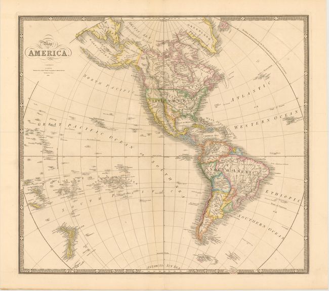
This handsome, large map features the Independent Republic of Texas with its southern border on the Rio Grande and the northern border on the Arkansas, thus incorporating Santa Fe. In Alaska (Russian Possessions), the discoveries of Dease and Simpson are noted at Point Barrow. The map extends through the Pacific Ocean to include New Zealand and the Pacific Islands where Hawaii is prominently shown. In South America, there is still a remnant of Lake Parime. In the Antarctic Icy Sea, and just peaking out of the keyboard-style border are the South Sandwich Islands, labeled Sandwich Land and Southern Thule.
References:
Condition: A
Wide margins and original outline color on sturdy paper, with a light crease adjacent to centerfold and a short centerfold separation in bottom blank margin, far from map image.