Subject: Atlases
Period: 1851 (circa)
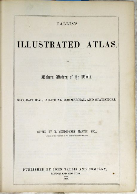
Publication:
Color: Hand Color
Size:
11 x 15 inches
27.9 x 38.1 cm
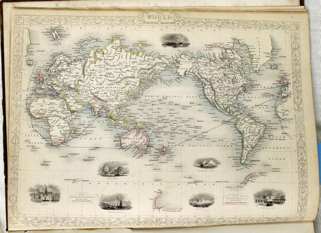
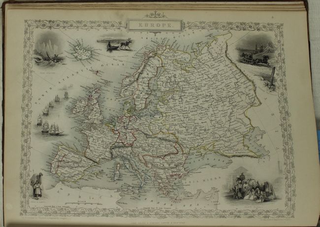
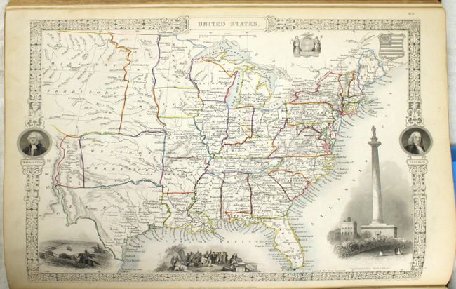
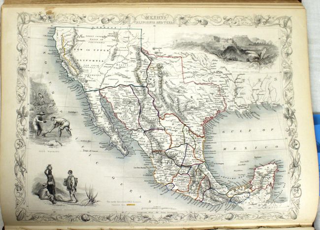
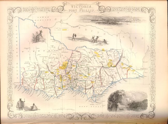
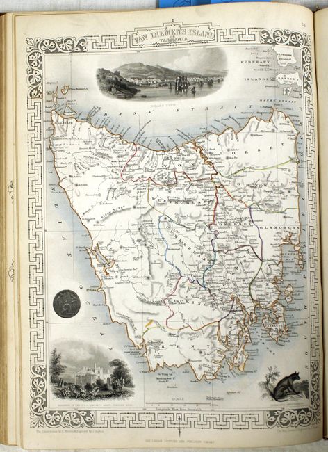
The maps from The Illustrated Atlas were first published in serial form to a target audience that led insular lives due to the expense and hardship of travel. All that changed as the progress of the nineteenth century brought swift and dramatic changes in public awareness of far away places. Tallis' maps no doubt played an important role in this dramatic awakening. These maps not only provided up-to-date geographical knowledge, but also used vignette views within the map's design to show the native people and their occupations, cities and points of interest. The maps hark back to a cartographic tradition from the Dutch mapmakers of the seventeenth century with finely engraved decorative borders. The maps were drawn and engraved by John Rapkin with views drawn and engraved by a number of prominent artists. The maps were issued as a complete volume from 1851 until about 1865. Some of the maps were also published in other history books published by Tallis including British Colonies and, without the vignettes, in geographical dictionaries and encyclopedias until about 1880.
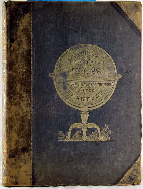
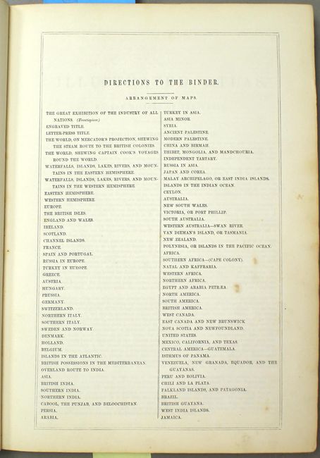
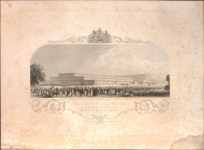
This scarce and very desirable folio atlas is one of the last "decorative type" atlases to be published. Sometimes called the "Tallis Atlas", this complete example contains 81 maps, 2 charts, a frontispiece view of The Great Exhibition of the Industry of all Nations and related text pages interspersed throughout. Each of the steel plate engraved maps feature at least one engraved vignette, many with two or more, and help to make this a truly beautiful atlas. The Mexico, California and Texas map is the Gold Rush version with the added vignette titled "Gold Washing" and the gold region of California identified with yellow color along the Rivers Sacramento and San Joaquin. The Victoria, or Port Phillip map also shows "The Gold Diggings" areas highlighted in yellow. This edition has a total of seven maps of Australia, Tasmania and New Zealand. Hardbound in original brown half calf with cloth boards embossed with a gilt globe and title on spine. Sheets are all edges gilt.
References:
Condition: B+
The maps are in original outline color and the vignettes and borders are uncolored, as issued. Maps are mostly fine to very good with just a few good due to small stain or light foxing. Frontispiece shows some foxing and there is some light staining of the endpapers. All pages are evenly and pleasantly ivory age toned. Covers show typical wear with rubbing and wear to cloth. The hinge is starting and the front cover partially detached.