Subject: Atlases
Period: 1820 (published)
Publication:
Color: Hand Color
Size:
12.3 x 17.8 inches
31.2 x 45.2 cm
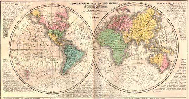
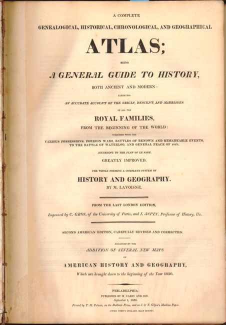
This is Lavoisne's second American edition folio atlas "carefully revised and corrected" by C. Gros and J. Aspin. Published by M. Carey and Sons, and printed by T.H. Palmer "on the Ruthven Press, and on J. & T. Gilpin's Machine Paper." The atlas is complete and contains 28 double-page maps, plus scores of detailed and colorful tables, chronological and historical, on 71 plates. The maps are listed below.
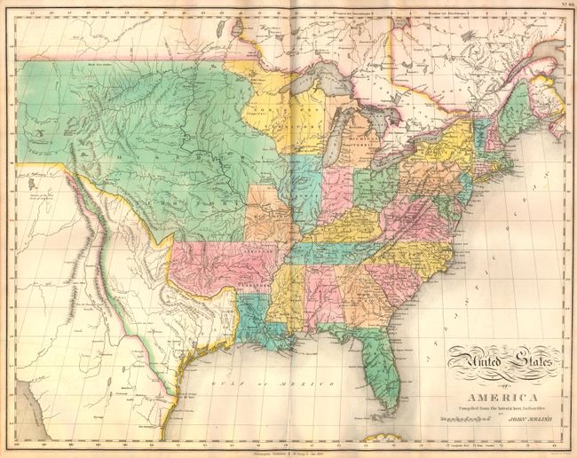
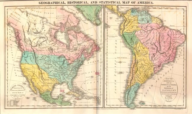
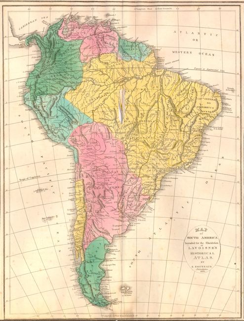
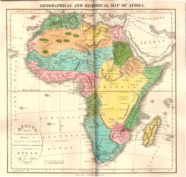
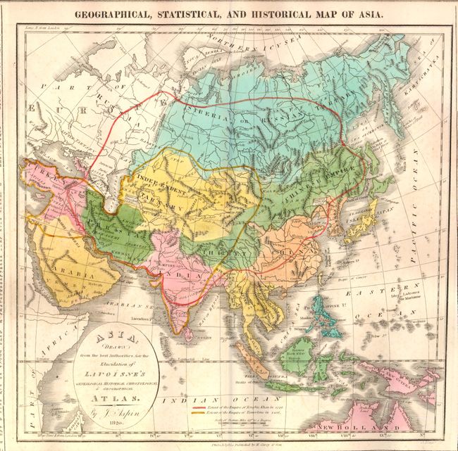
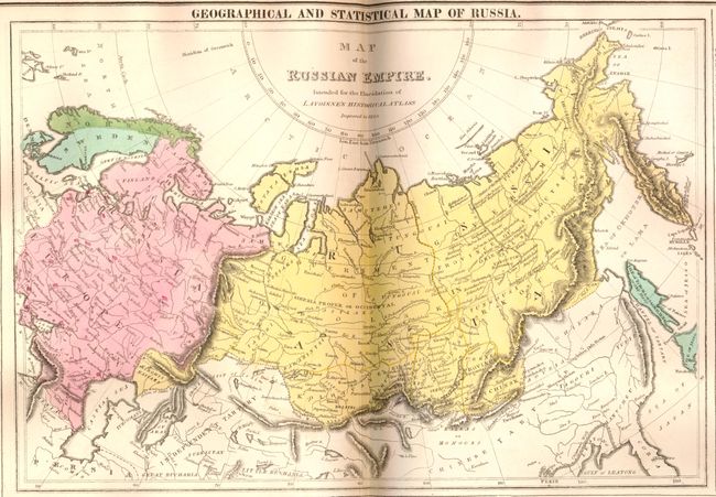
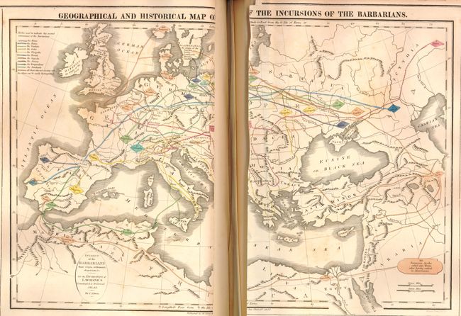
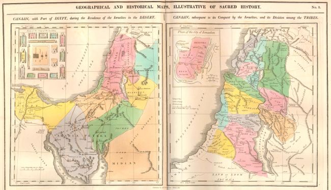
World in hemispheres; Ancient World; Ancient World of Noah (2" centerfold separation in center); Canaan & Egypt (two single-page maps); Ancient Greece; Roman Empire; Incursion of the Barbarians (split in half along centerfold); Europe 1820; England, Scotland & Ireland; England & Wales; Scotland; Ireland; France; France…Treaty of 1815 with Netherlands, Switzerland and part of Italy; Spain & Portugal; Germany; Kingdom of Netherlands; Italy; Poland; Russia; Denmark (single page); Sweden (single page); Turkey in Europe (single page); Turkey in Asia (single page); Asia; China; Hindoostan or India; Africa; North America (single page); South America with the Conquests of Pizarro (single page); United States (centerfold separation that enters map image 1.5" at bottom, and two 1" tears through Mississippi and Tennessee); and South America (detached, with 2" tear along centerfold in Brazil and short tears in bottom blank margin).
The United States map, by John Melish, provides a detailed view of the Missouri River and the headwaters of the Columbia River based on information from Lewis and Clark's expedition. The new state of Missouri is shown with a straight western border. Michigan Territory includes the eastern part of present-day Wisconsin, which is still a part of the North West Territory. The large Arkansas Territory takes in most of present-day Oklahoma. Texas is a part of Mexico. One of the most interesting features of the map is the river system in the West, near the Highest Peak, where the headwaters of several major rivers all originate within a few miles of one another - Red River of California (Colorado), Multnomah (Willamette), Rio del Norte (Rio Grande), Arkansaw (Arkansas), and the Platte.
Hardbound, half calf over blue paper-covered boards, gilt titling on spine. Title page, introduction, contents, maps and tables.
References:
Condition: B+
Overall maps are in good to near fine condition in original color, with occasional light foxing and a few with short centerfold separations at bottom far from map image. Exceptions are noted in description. Covers are stained and worn and spine has been reinforced with bookbinding tape and archival tape. Endpapers are stained with foxing and tears. Front and back hinges are starting.