Subject: Western Hemisphere
Period: 1728 (published)
Publication: Atlas Maritimus & Commercialis
Color: Hand Color
Size:
27 x 23.5 inches
68.6 x 59.7 cm
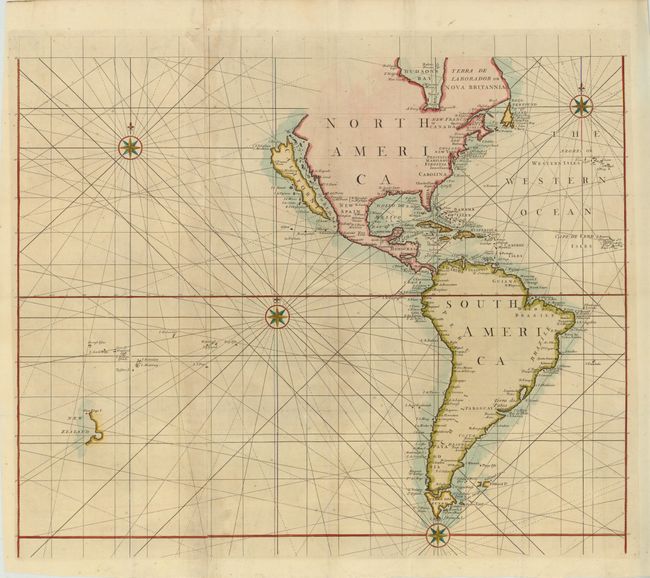
This sea chart depicts the Western Hemisphere of the four-sheet world map A Correct Sea Chart of the Whole World..., for which the title cartouche resides on the Eastern Hemisphere sheet. The chart depicts the Island of California, with the northwest coast of North America indented before trailing off. The interiors of North and South America are not delineated, with place names focused on the coasts. The Falkland Islands are only partially delineated, and the western coast of New Zealand is shown in the south Pacific. Published by J. & J. Knapton and John Senex. The sheet stands well on its own and is decorated with three compass roses. On two sheets, joined.
References: McLaughlin #207; Shirley (BL Atlases) #M.HALL-1a, #1; Wagner, H. (NW) #532.
Condition: B+
Issued folding, now pressed, with light soiling. There is a short fold separation and two 1" tears west of South America that have been professionally repaired. There is a minute hole near the Galapagos Islands, only visible when held to light.