Subject: Western Africa
Period: 1743 (dated)
Publication:
Color: Hand Color
Size:
22.3 x 18.3 inches
56.6 x 46.5 cm
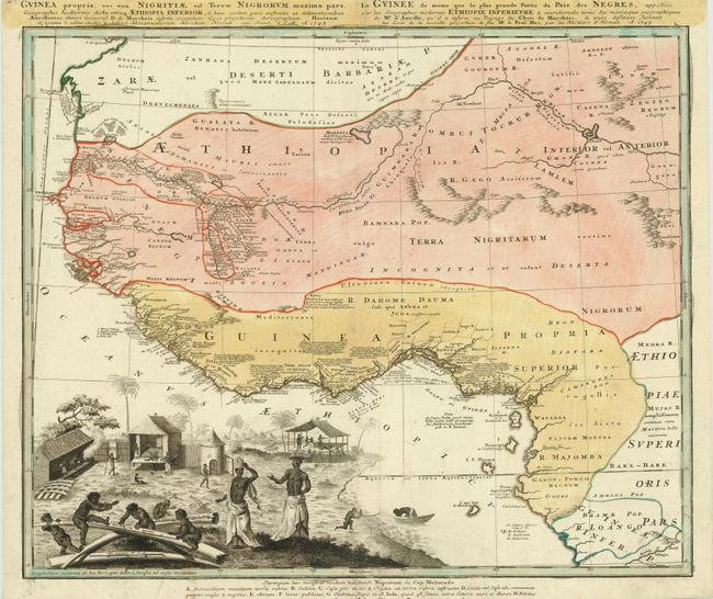
This remarkable map is one of the most detailed maps of West Africa produced during the mid-eighteenth century. Information is confined only to those regions that were well known and it is particularly well delineated along the Niger River and the coast where there are extensive notations. The map is embellished with a large vignette of a native village with the distance scales engraved onto elephant tusks representing this important trade commodity of the region. A key at the bottom of the map identifies the various peoples and types of habitats. There is a French title at the top right.
References:
Condition: A
Old color with a short centerfold separation at bottom that just enters neatline has been professionally repaired. One small insignificant spot off the coast of Guinea.