Subject: Western Hemisphere
Period: 1722 (dated)
Publication:
Color: Hand Color
Size:
24.3 x 19.3 inches
61.7 x 49 cm
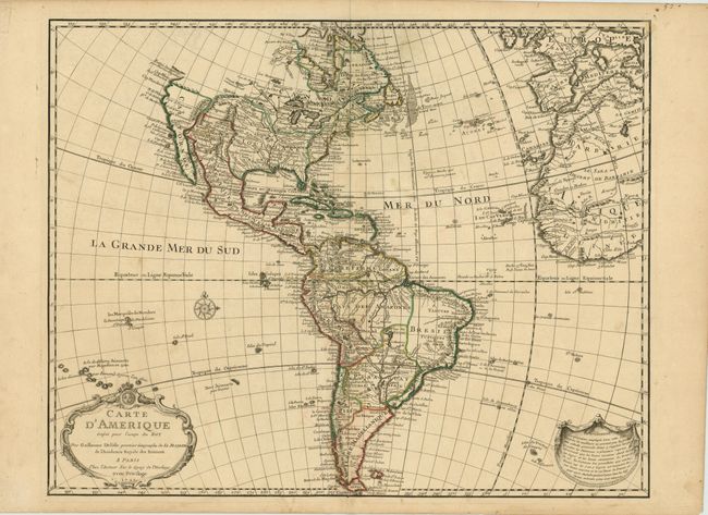
This is the scarce, first state of one of the most popular maps of the 18th century. The detailed map of the Americas provides a great deal of information about the state of geographic knowledge in the New World in the early part of the century. In North America the western coast is blank above California. The French territory of Louisiane takes up the lion's share of North America at the expense of the British colonies. This political bias is due to Delisle's position as geographer to the King of France. South America is well represented with a good depiction of the river systems and the locations of the Jesuit missions. The first state can be distinguished by the fancy lettering for d'Amerique in the cartouche. The map has a long publishing history that spans nearly 100 years!
References: Tooley (Amer) p. 13, #1; cf Portinaro & Knirsch CXIV (2nd state).
Condition: A
Nice impression and original outline color with wide original margins. There are a couple insignificant damp stains in the map, else overall very good.