Subject: Northern Africa
Period: 1535 (circa)
Publication:
Color: Hand Color
Size:
16 x 12.5 inches
40.6 x 31.8 cm
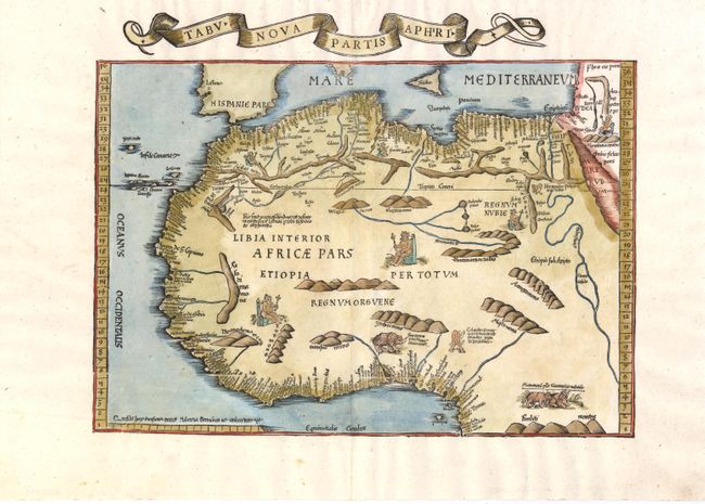
Based on Waldseemuller's map, this is one of the earliest "modern" maps of Northern Africa. The map extends from the Mediterranean in the north to the Equator in the south, and from the Canary Islands in the west to the Red Sea in the east. Details are focused primarily along the coastline, with numerous place names noted. The interior of Africa is filled with spurious mountain ranges and rivers. The map is adorned with depictions of kings on their thrones, a Cyclops, a rhino, and a pair of water buffalo.
References: cf. Norwich #286.
Condition: B+
A few tiny worm tracks along centerfold, with a minute amount of image in facsimile.