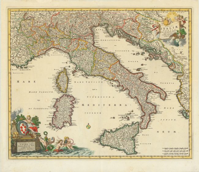
Subject: Italy
Period: 1698 (circa)
Publication:
Color: Hand Color
Size:
22.3 x 18.3 inches
56.6 x 46.5 cm
This superb map of Italy extends to include Savoy, Corsica and Sardinia in the west, and through the Dalmatian coast and Corfu when that region was controlled by the Republic of Venice. The map is filled with detail on the cities, towns, universities, and post roads. It is beautifully ornamented with putti surrounding the title cartouche in the upper right corner, and mermaids, Europa, and the coat of arms of the House of Medici surrounding another cartouche in the opposite corner.
References:
Condition: A
A small hole west of Sardinia has been expertly infilled, and a few short tears in blank margins have been professionally repaired. There are a few minute worm holes at top center, only visible when held to strong light.