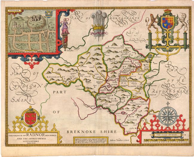
Subject: Wales
Period: 1610 (dated)
Publication: The Theatre of the Empire of Great Britaine
Color: Hand Color
Size:
20 x 15 inches
50.8 x 38.1 cm
This beautiful map of Radnorshire was engraved by Jodocus Hondius. It includes four decorative cartouches, a view of the castle at Radnor, scale of miles, coat of arms, title, also Prince of Wales feathers and fancy script lettering. Speed rarely credited his sources, but in this case he credits his great predecessor, Christopher Saxon, with the basic information on this map. Saxon published his atlas in 1579 and included regional maps of Wales. Speed wanted to make his atlas distinctive, so he separated his maps into individual counties. There is modest detail throughout the map. English text on verso with the imprint of John Sudbury and George Humbell, published circa 1627.
References:
Condition: B+
Beautifully colored and a dark impression with some minor soiling and two three-inch creases on the right side of the image near the neatline.