Subject: Warwickshire, England
Period: 1722 (published)
Publication: Brittania
Color: Black & White
Size:
16.5 x 14.5 inches
41.9 x 36.8 cm
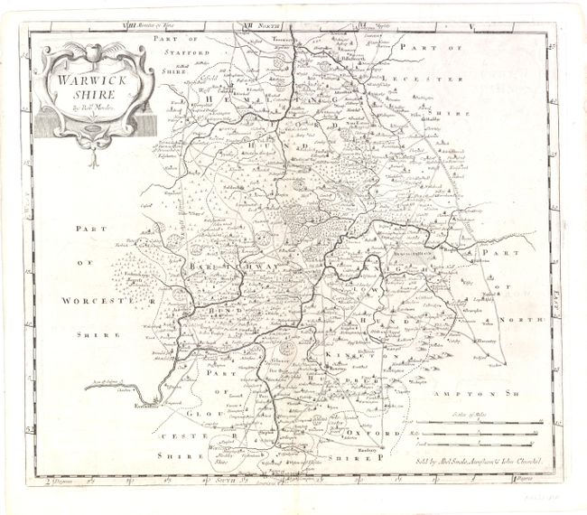
This map illustrates the area surrounding Warwick and Coventry. The River Avon bisects this county map and the famous Stratford-upon-Avon, birthplace of William Shakespeare, is prominently featured. The map includes a decorative cartouche and three distance scales. An inscription on the map indicates that the map was sold by Abel Swale, Awnsham and John Churchill.
Morden was one of the first English cartographers to show longitudes measured from the meridian of St. Paul's Cathedral (shown in degrees at the bottom of the map) and time in minutes measure locally from the sun (shown at the top). The roads on his maps are based on Ogilby's earlier survey. The Britannia was first published by historian William Camden (1551-1623) in 1586. After the publication of the final edition of Britannia in 1637, the work was not published again until 1695 when Gibson revised and translated the text from the original Latin and included fifty maps, mostly of the English counties, prepared by Robert Morden, replacing the outdated maps of Christopher Saxton. This map is from the subsequent edition of 1722.
References:
Condition: B+
There is some faint offsetting in the image, else very good. Watermarked paper.