Subject: Oxford, England
Period: 1722 (published)
Publication: Britannia
Color: Black & White
Size:
14.3 x 16.8 inches
36.3 x 42.7 cm
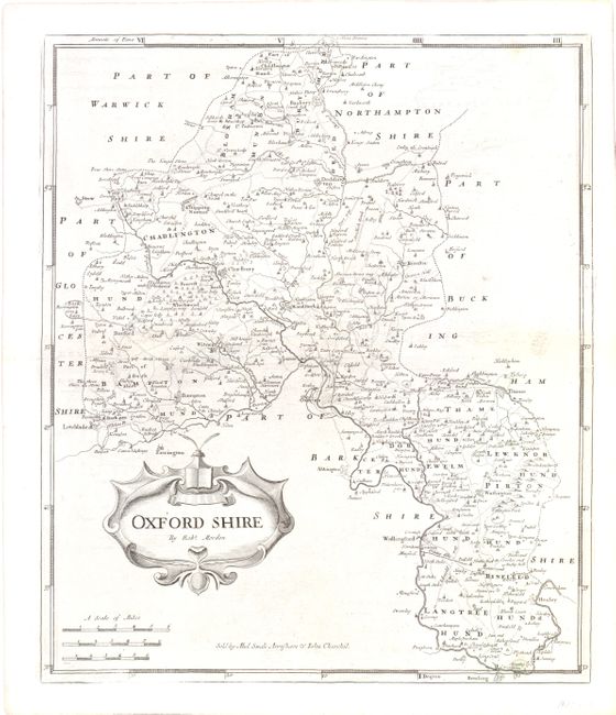
This is a map of Oxfordshire, covering the area from Banbury south to Wallingford and from Letchlade east to Thame. The town of Oxford, founded more than a thousand years ago, is shown near the center of the map along the Thames River. Oxford is the home of the University of Oxford, the oldest university in the English-speaking world. There is a decorative cartouche and three different distance scales. Sold by Abel Swale, Awnsham & John Churchil.
Morden was one of the first English cartographers to show longitudes measured from the meridian of St. Paul's Cathedral (shown in degrees at the bottom of the map) and time in minutes measure locally from the sun (shown at the top). The roads on his maps are based on Ogilby's earlier survey. The Britannia was first published by historian William Camden (1551-1623) in 1586. After the publication of the final edition of Britannia in 1637, the work was not published again until 1695 when Gibson revised and translated the text from the original Latin and included fifty maps, mostly of the English counties, prepared by Robert
Morden, replacing the outdated maps of Christopher Saxton. This map is from the subsequent edition of 1722.
References:
Condition: B+
There is some light offsetting in the image and minor extraneous creasing near the centerfold. Watermarked paper.