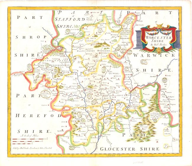
Subject: Worcestershire, England
Period: 1722 (published)
Publication: Brittania
Color: Hand Color
Size:
16 x 14 inches
40.6 x 35.6 cm
This county map of Worcestershire shows a few towns and parks in the surrounding counties with an early depiction of the county’s roads. The map displays small towns, buildings, forests and parks, which are noted by fenced areas. There is an attractive drape-style cartouche and three different distance scales. Sold by Abel Swale, Awnsham & John Churchil.
Morden was one of the first English cartographers to show longitudes measured from the meridian of St. Paul's Cathedral (shown in degrees at the bottom of the map) and time in minutes measure locally from the sun (shown at the top). The roads on his maps are based on Ogilby's earlier survey. The Britannia was first published by historian William Camden (1551-1623) in 1586. After the publication of the final edition of Britannia in 1637, the work was not published again until 1695 when Gibson revised and translated the text from the original Latin and included fifty maps, mostly of the English counties, prepared by Robert Morden, replacing the outdated maps of Christopher Saxton. This map is from the subsequent edition of 1722.
References:
Condition: A
There is some light offsetting, else fine. Watermarked paper.