Subject: Britain
Period: 1709 (dated)
Publication: Atlas Francois
Color: Hand Color
Size:
25.5 x 18 inches
64.8 x 45.7 cm
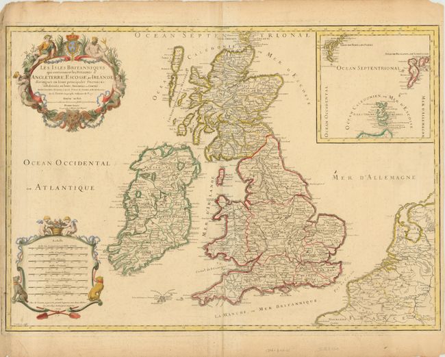
This is an attractive map of the British Isles filled with fine detail of hundreds of place names. The map has two decorative cartouches including the title cartouche with putti, Neptune, a merman and mermaid, and the French coat of arms. The second cartouche contains eight distance scales and is adorned with a pair of putti and hunting dogs. Jaillot was the successor to the Sanson publishing family and this map follows the geography of Nicolas Sanson, as well as the previous work of Saxton, Speed, Pont, Gordon and Boazio. A large inset details the Shetland, Faroe and Orkney Islands. The map was engraved by Cordier and the cartouches were engraved by Simmoneau, whose signature S[immoneau] f[ecit] appears below each.
References: Shirley (BI) Jaillot 3.
Condition: B
Original outline color on watermarked paper with light toning along centerfold, a few faint spots, and marginal soiling.