Subject: Britain
Period: 1631 (dated)
Publication: Gerardi Mercatoris Et I. Hondii Atlas…
Color: Hand Color
Size:
19.8 x 14.8 inches
50.3 x 37.6 cm
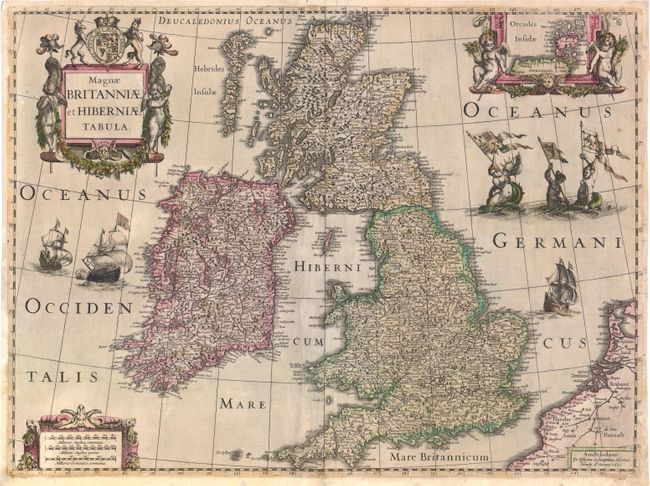
A boldly embellished map of the British Isles densely packed with information. The beautifully engraved map includes an inset of the Orkney Islands enclosed in a cartouche flanked by putti. The map is further adorned with sailing ships, mermaids displaying armorial flags and elaborate title and distance scale cartouches. This was one of several maps introduced by Hondius and Jansson in response to increased competition from their rival Willem Blaeu. Although dated 1631, this map only appeared in the Hondius-Jansson Atlas between 1633 and 1644. This example is from a German edition published between 1633-38, with German text on verso.
References: Shirley (BI) #435.
Condition: B
Original color with some professional repairs along centerfold. Backed in Japanese tissue to reinforce several cracks towards the bottom at right and left. The margins have been trimmed, but are ample for framing.