Subject: Ancient World
Period: 1574 (dated)
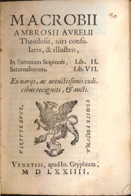
Publication: In Somnium Scipionis
Color: Black & White
Size:
4.3 x 6.5 inches
10.9 x 16.5 cm
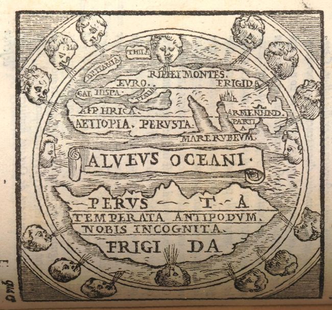
This work, written by Ambrosius Macrobius, is a commentary on Cicero's Dream of Scipio. It includes a rare woodcut map of the world illustrating Cicero's interesting theories. This diagrammatic map shows two distinct regions of the earth. The inhabited Afro-Eurasian continent was balanced by an unknown, and relatively equal, landmass (Temperata Antipodunobis Incognita) on the other side of an impassable torrid zone (Perusta) and a great boiling sea (Alveus Oceani). It was this notion of antipodean balance and landmass equivalence that continued to attract Renaissance minds to the otherwise outmoded geographical ideas of Macrobius. Distinguished cartographers like Mercator and Ortelius would later incorporate Macrobius' model into an immense southern continent (Australis Incongita) to balance the known lands of the world, and the division of the world into climactic zones is still in use today.
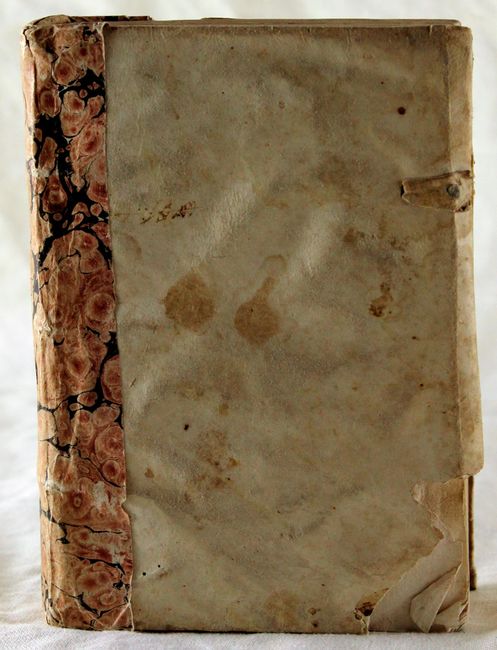
Macrobius was a 5th century Roman neoplatonic philosopher. His commentary on Cicero’s Somnium Sciponis was of great influence in the Middle Ages and gained popularity with the advent of printing. First published in Brescia in 1483, numerous editions appeared throughout the 16th century. His commentary includes several chapters dealing with his own conception of the world and the universe. It also contains references to many facets of the scientific knowledge of his time, including references to physics, astronomy, and mathematics. This edition was published by Johann Gryphius. Title page, 567 pp. (map at p. 144), and extensive index. The volume is bound in original soft vellum binding, with clasps missing, and a marbled paper spine.
References: Shirley #13.
Condition: A
The map is in near fine condition, with faint spots in blank margins. The text has occasional light spots, and last few pages of index have a damp stain in upper-right corner. The contents and binding are tight with all pages sound. There is an old repair to spine, and bottom right corner of front cover is chipped.