Subject: Atlantic Ocean
Period: 1710 (circa)
Publication:
Color: Hand Color
Size:
39 x 23.5 inches
99.1 x 59.7 cm
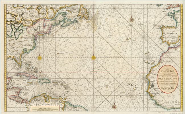
This sea chart of the Atlantic is filled with place names along the coastlines. In the western hemisphere, the map extends from Newfoundland to the equator, including the northern coast of South America and the Caribbean Islands. In North America, the majority of the Great Lakes are shown, along with an exaggerated Long Island (Long I. ou Jork Shire), and a large lake (Apalache Lac) in South Carolina. Florida is presented in a triangular shape, with large islands forming the tip and numerous soundings along the coast. The coasts of Britain, France, Spain, and western Africa are shown in the eastern hemisphere. A large cartouche contains the title in Dutch, French and English, and four compass roses complete the composition. Engraved by I.van Anse. On two sheets, joined as issued.
References:
Condition: B+
Two vertical strips of paper loss along the coast of Africa and through the Caribbean have been expertly repaired with map image in facsimile. There are a few small cracks along borders that have been professionally repaired.