Subject: World
Period: 1850-60 (circa)
Publication:
Color: Hand Color
A. A New Map of the World on the Globular Projection by S.A. Mitchell, circa 1850, hand color, (14 x 9.3"). This double hemispheric map details the major transportation routes, the track of historical explorers, large cities and watersheds. Portions of the continent of Antarctica is coming into view. The map is surrounded by the decorative scroll border. Condition - Lightly toned with some scattered foxing (B).
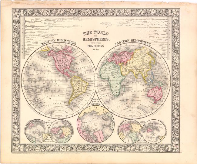
B. The World in Hemispheres with Other Projections... by S.A. Mitchell, dated 1860, hand color, (13 x 11"). A lovely double hemisphere map with Mitchell's unique floral border. Below the world map are three smaller maps: The World on a Polar Projection; North Polar Region; Land and Water Hemispheres. A comparative diagram of the world's rivers is shown above the maps with the note "Sea of Uniamezi Probable Source of the Nile". Condition - a few minor spots in the image and the blank margin is slightly crumpled where it was bound (B+).
References:
Condition:
See descriptions.