Subject: Greater Antilles
Period: 1692 (circa)
Publication: Die Nieuwe Groote Lichtende Zee-Fackel…
Color: Hand Color
Size:
23.5 x 20.5 inches
59.7 x 52.1 cm
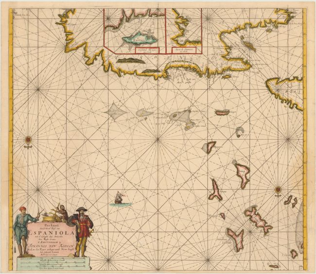
This handsome sea chart depicts the northern part of Hispaniola, the eastern end of Cuba, the adjacent Turks & Caicos Islands and the southern Bahamas as far north as San Salvador. Presented on an unusual projection, north is oriented to the bottom of the sheet. There are two large insets providing details of Tortuga Island and Port of Guanives. The map is adorned with a compass rose, sailing ship, and a figurative cartouche flanked by two swashbuckling pirates.
References:
Condition: B+
A good example with a dark impression and ample original margins for this issue. There is light soiling and a centerfold separation that enters map image 1/4" at bottom. There are three professionally repaired tears in blank margins, two of which just enter map border at right and left.