Catalog Archive
Auction 138, Lot 384

"Les Isles Antilles &c. Entre Lesquelles Sont les Lucayes, et les Caribes", Sanson, Nicolas
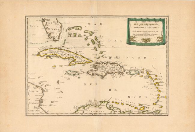
Subject: Caribbean

Period: 1656 (dated)

Publication:

Color: Hand Color

Size:
21.8 x 15.3 inches
55.4 x 38.9 cm
Download High Resolution Image
(or just click on image to launch the Zoom viewer)

Beautiful map of the Caribbean from the tip of Florida to the western coast of Central America and the northern coast of South America. The map shows excellent detail of the Bahamas, Cuba, Jamaica, Hispaniola, Puerto Rico and the Windward Islands. The map is decorated with a delicately engraved, drape-style cartouche.

References:

Condition: B+

Original color and a nice impression. Map has been trimmed to neatline and pasted to old paper for inclusion in a composite atlas. There are a few faint spots and the large margins have light soiling.

Estimate: $750 - $900

Unsold

Closed on 12/7/2011

Archived