Subject: Gulf of Mexico and Caribbean
Period: 1640 (circa)
Publication: Novus Atlas
Color: Hand Color
Size:
20.3 x 14.8 inches
51.6 x 37.6 cm
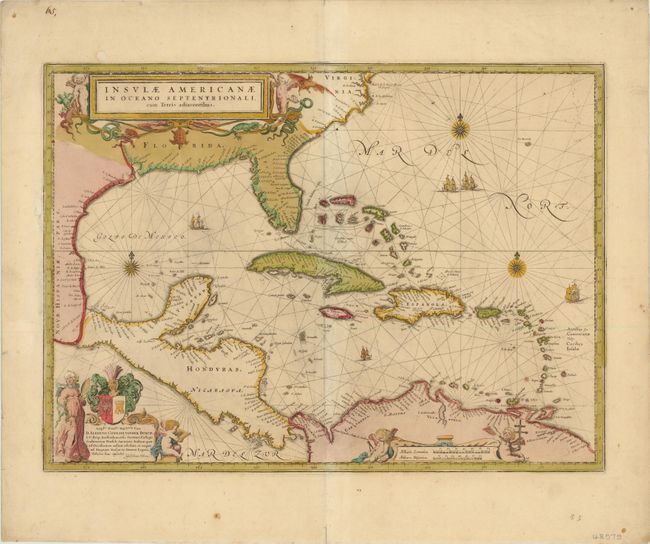
This fine map centered on the West Indies reflects the firsthand knowledge of Hessel Gerritsz during his voyage to South America and the West Indies undertaken in 1628. It covers the same region as the Gerritsz map of 1631; from Chesapeake Bay to the northern coastline of South America, with the addition of the west coast of Central America. The nomenclature in North America is virtually identical with the notable addition of the name Virginia. The nomenclature was probably derived from a Spanish chart as it lacks any French influence. The map is richly adorned with three lovely cartouches, sailing ships, rhumb lines and compass roses. There is no text on verso, indicating this was published in a composite atlas after the destruction of Blaeu’s publishing house in 1672. There is no additional publisher’s imprint, but Bleau’s plates are known to have been sold to Frederick de Wit, Pierre Mortier, and Schenk and Valck.
References: Burden #242.
Condition: B
Original color and nice dark impression. There are a few repairs at the left margin near the neatline and one other at the upper neatline just above the title cartouche. There is a slight crease in the upper right portion of the sheet and a few small spots in the blank margin.