Subject: Central America
Period: 1715 (circa)
Publication: Galerie Agreable du Monde
Color: Black & White
Size:
16 x 13 inches
40.6 x 33 cm
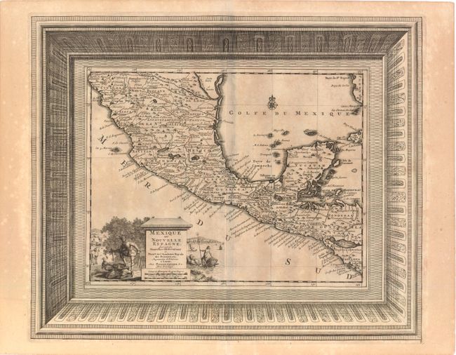
This finely engraved map covering nearly all of Mexico and Central America to northern Costa Rica is presented within a splendid picture-frame border, which was printed from a separate copper plate. The map depicts the new conquests made by the Spanish in Mexico and Central America, and is filled with place names and topographical details. A lovely pictorial cartouche depicts a conquistador subjugating two natives on the left, and Neptune riding his chariot along the coastline on the right, with a spouting whale and ships in the background.
The Galerie Agreable du Monde was issued in 66 parts containing over 3000 maps, town plans and topographic prints. It was the largest picture and map book ever published. Many of the engravings were printed from multiple plates and enclosed in elaborate, picture-frame borders. The Galarie was reportedly only issued in 100 copies (Tooley, Dictionary of Mapmakers).
References:
Condition: B+
Sharp impression on watermarked paper with light, uneven toning and some offsetting along centerfold.