Subject: World
Period: 1783 (dated)
Publication:
Color: Black & White
Size:
20.3 x 13.5 inches
51.6 x 34.3 cm
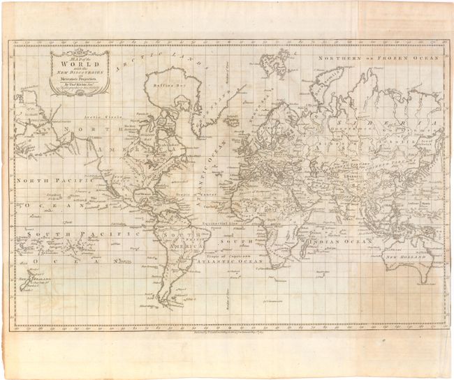
This map presents an interesting view of the world in 1783. The Eastern U.S. is still labeled British Colonies. The remainder of North America lacks boundaries, although the areas of New Albion, New Mexico, Louisiana, and Canada are named. Port Sir Francis Drake appears to be San Francisco Bay. The islands of the Pacific Ocean seem to receive special attention, with O-Why-Hee featured within the Sandwich Islands. Australia (New Holland) is almost fully delineated, except Tasmania (Van Diemens Land) is still attached. Russian Siberia is made up of the Government of Siberia and the Government of Irkutsk.
References:
Condition: B
Folding, as issued with light offsetting and some uneven toning. The right-hand margin has been trimmed to neatline for binding.