Catalog Archive
Auction 138, Lot 286

"The Peninsula and Gulf of Florida, or New Bahama Channel, with the Bahama Islands", Jefferys/Laurie & Whittle
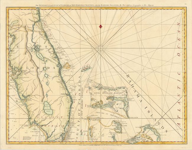
Subject: Florida

Period: 1794 (dated)

Publication: West India Atlas

Color: Hand Color

Size:
24.8 x 19 inches
63 x 48.3 cm
Download High Resolution Image
(or just click on image to launch the Zoom viewer)

This fabulous naval chart is one of the most important maps of Florida, being the earliest relatively accurate map of the region. The hydrographic detail of the coastline and the channels in the Bahamas is excellent and it remained the standard sailing chart for the Florida seas during the last part of the 18th century. Beautifully engraved with rhumb lines and tiny ships. This is the third state with Laurie & Whittle's imprint at bottom. It is one sheet of the sixteen-sheet map of the West Indies that formed the heart of this important Revolutionary War period atlas. Sheet number DG.4 is printed at upper right.

References: Stevens & Tree #26c; cf. Sellers & Van Ee #1608.

Condition: A

A touch of faint offsetting.

Estimate: $1,600 - $2,000

Sold for: $1,000

Closed on 12/7/2011

Archived