Catalog Archive
Auction 138, Lot 265

One of the First Atlas Maps of Alaska Territory

"North Western America Showing the Territory Ceded by Russia to the United States", Mitchell, Samuel Augustus
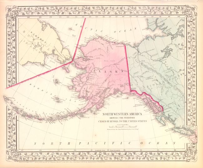
Subject: Alaska

Period: 1867 (dated)

Publication:

Color: Hand Color

Size:
14.3 x 11.5 inches
36.3 x 29.2 cm
Download High Resolution Image
(or just click on image to launch the Zoom viewer)

This early map of Alaska is dated only three years after the territory was purchased from Russia, and infamously named Seward's Folly. It shows Alaska with no organized areas and the interior virtually blank, save for the occasional river and Fort Yukon. Just a few villages are named and there is no sign of Mt. McKinley. Sitka is called New Archangel. Enclosed in a decorative grapevine border.

References:

Condition: A

Nice impression with full original color. There are a few tiny spots and some minor creasing in the top blank margin where the map was bound, well away from the image.

Estimate: $100 - $130

Sold for: $75

Closed on 12/7/2011

Archived