Subject: Western United States, California, Nevada
Period: 1874 (dated)
Publication:
Color: Printed Color
Size:
34 x 40.5 inches
86.4 x 102.9 cm
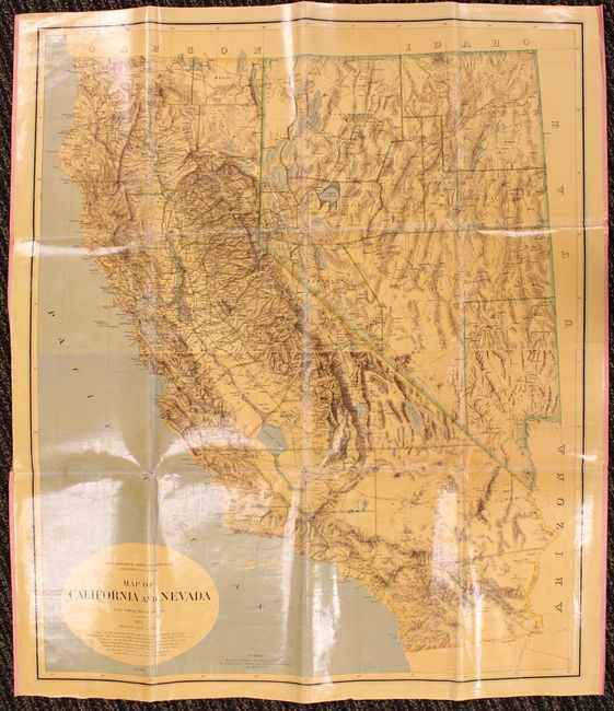
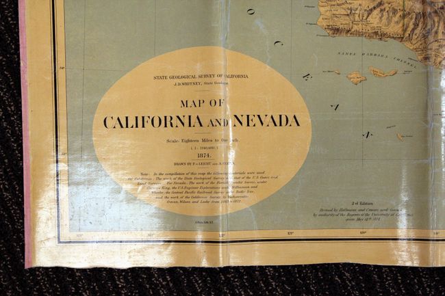
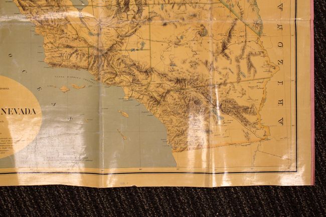
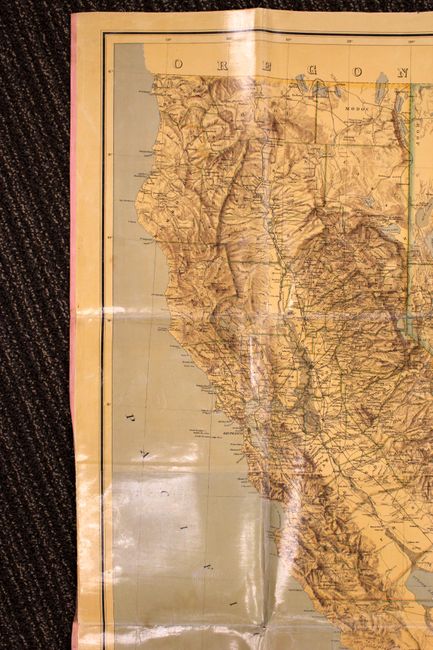
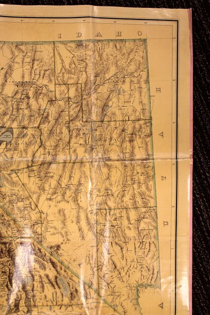
Ten years after being admitted to the Union, the California legislature approved funding for a detailed survey of the area. This important map was a direct result of that work and was the first map to display the physical geography with a high degree of accuracy. This large format map shows great detail of topography, watersheds, roads and cities. County boundaries are highlighted in color and the configuration is current as of 1874 with Modoc being formed from Siskiyou in California, and Eureka County being formed from Lander in Nevada. Compiled by J.D. Whitney, who served as the State Geologist of California and director of the first Geological Survey of California. His team of geologists and geographers, including Clarence King and William Brewer, conducted this important survey using triangulation and completed the first scientific survey of the Sierra Nevada. Published by the State Geological Survey of California. Second edition, revised by Hoffman and Craven and issued by authority of the Regents of the University of California given May 12th 1874.
References: Wheat (TMW) #1243; Heckrotte & Sweetkind, #39.
Condition: B
Linen backed and varnished. The map has been folded and there are a few separations at the fold intersections and some minor wrinkling and slight discoloration along the folds.