Subject: Southern United States
Period: 1763 (circa)
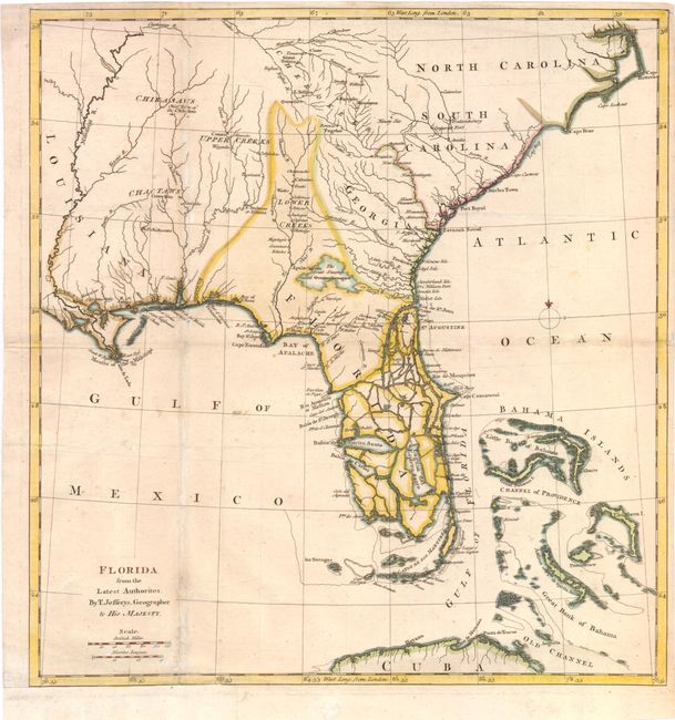
Publication: An Account of the First Discovery, and Natural History of Florida
Color: Hand Color
Size:
14 x 15 inches
35.6 x 38.1 cm
This scarce map was featured in William Roberts' An Account of the First Discovery, and Natural History of Florida, which was published at the end of the Seven Years War. Jefferys based this map on numerous French and Spanish charts taken from prize ships during the war. The map depicts the British colonies of North Carolina, South Carolina, Georgia and the newly acquired Florida, formerly a Spanish territory. The Florida peninsula is depicted as a maze of islands. The interior gives good detail of settlements and rivers, and Indian nations. Although North Carolina is named, no information is given except for the names of the three capes. The map extends to include the Bahama Islands and the northern tip of Cuba.
References: Cumming #334; Ste. Claire #15.
Condition: B+
Issued folding, now pressed, on watermarked paper. A few fold separations have been repaired, and a binding trim at bottom left has been remargined.