Subject: World
Period: 1598 (circa)
Publication: La Geografia di Claudio Tolomeo Allessadrino…
Color: Hand Color
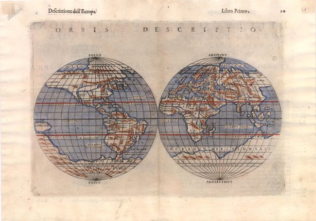
A. Orbis Descriptio, (10.3" x 7.3"). This world map is elegantly engraved in the characteristic Italian style, adapted from the oval projection used by Gastaldi, and presented on what is known as Roger Bacon's circular projection. This projection was popularized by Ruscelli and later by Rumold Mercator. Another important feature of the map is the apocryphal bulge in South America; one of the most copied cartographic errors of the 16th century. Terra Incognita is distinctly shown as a land bridge linking Asia and North America with its coastline labeled Littus incognitum. This is the second state with a distinctive southern continent and New Guinea appearing in the Pacific. Italian text on verso. Ref: Shirley #110; Manasek #20. Condition: Faint toning along centerfold with marginal soiling.
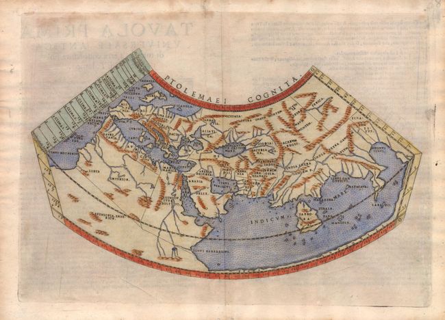
B. Ptolemaei Cognita, (10.3" x 6"). This Ptolemaic map is on a conical projection, and is engraved in the Italian style with a stippled sea. The Mediterranean is well depicted, but greatly exaggerated in length. In Africa, the Nile is shown originating from the Mountains of the Moon. The Indian Ocean is landlocked with a continuous coastline joining Africa to South East Asia. Taprobana, present day Sri Lanka, is a very large island in the Indian Ocean and the Indian sub-continent is completely missing, although the Ganges river is shown. Ref: Shirley #133. Condition: Lightly toned with two minute worm holes in lower blank margin, far from map image.
References:
Condition: B+
See description.