Subject: Eastern United States
Period: 1843 (dated)
Publication:
Color: Hand Color
Size:
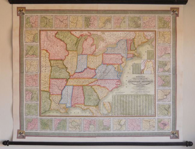
47 x 38 inches
119.4 x 96.5 cm
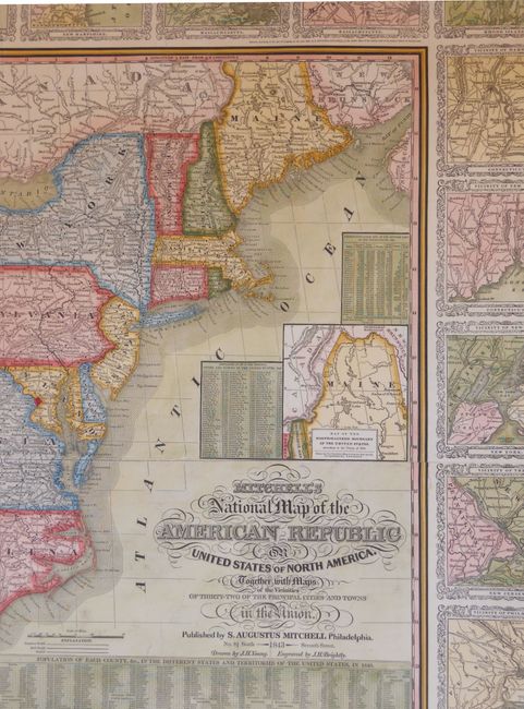
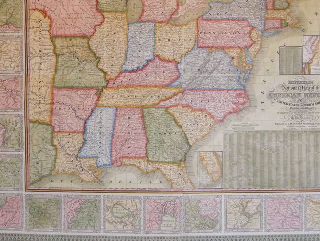
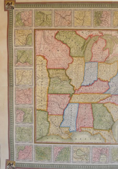
This is a very nice wall map that was drawn by J.H. Young and engraved by J.H. Brightly. It extends into the eastern part of the Independent Republic of Texas and the large Indian Territory. On this early edition Minnesota is not named, and west of Wisconsin is the huge Iowa Territory that is also labeled Dacotah or Sioux. A large inset within the map is a "Map of the North-Eastern Boundary of the United States according to the Treaty of 1842" that details the Webster-Ashburton Treaty, and another smaller inset "Map of the Southern Part of Florida" that shows no settlements of any kind south of Fort Jupiter. The map is very detailed with hundreds of place names, plus roads, villages, railroads, ports, etc. A table gives the 1840 population for 120 cities and another gives the states' population of Whites, Free Blacks and Slaves. The state of New Hampshire is listed with just one slave and 537 Free Blacks. Surrounding the map are 32 city plans, which itself is contained with a wide decorative border. This large wall map should not be confused with the smaller (24 x 34") and more common map with the same title. An extraordinary example of Mitchell's desirable wall map with the original wooden rollers.
References:
Condition: A+
Professionally and beautifully restored with new linen on verso. Varnish not used on the map surface.