Subject: Canada
Period: 1825-50 (circa)
Publication:
Color: Hand Color
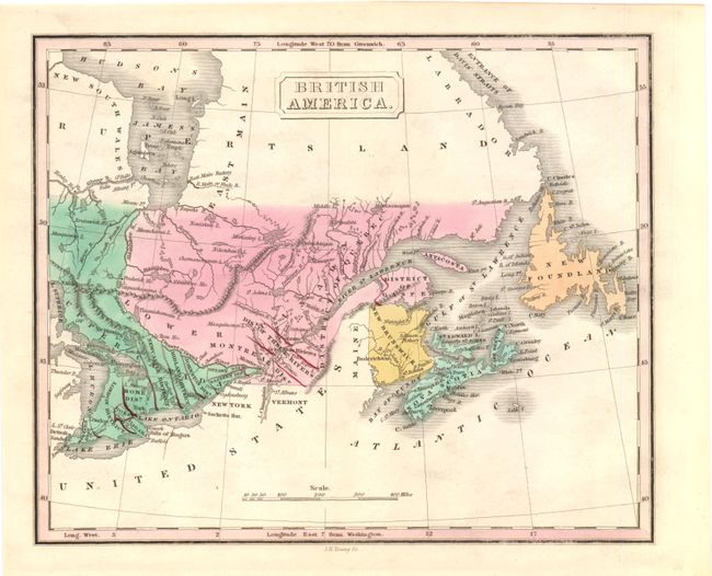
A. British America by James H. Young, circa 1825, hand colored (9.8" x 8"). This small map of eastern Canada highlights in hand color portions of Ontario and Quebec along with New Brunswick, Nova Scotia and New Foundland. Districts are highlighted in red outline color. Condition - (A)
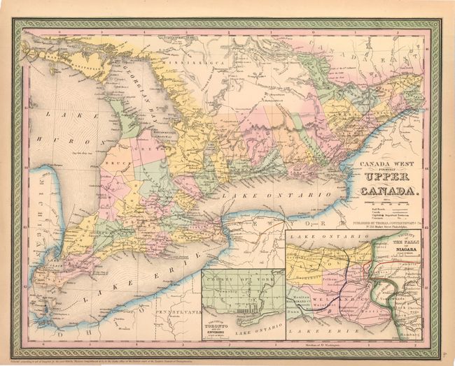
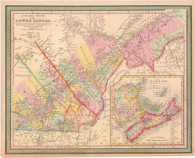
B. Canada West Formerly Upper Canada [and] Canada East Formerly Lower Canada , Thomas, Cowperthwait & Co., dated 1850, hand colored (15.8" x 12.5"). Matched pair of nicely engraved maps of Canada. The first map is centered on Toronto and shows all of Lake Erie and Lake Ontario and extends east to beyond Cornwall on the St. Lawrence. Insets of the City of Toronto and another of the vicinity of the Falls of Niagara. The second shows good detail along the St. Lawrence centered on Quebec with a large inset of the Maritime Provinces. Both are surrounded by attractive borders. Condition - both maps have some light toning and the map of Lower Canada has a torn lower left corner that has been repaired on verso with archival tape. (B+)
References:
Condition:
See descriptions.