Subject: Canada
Period: 1757 (circa)
Publication: Histoire Generale des Voyages
Color: Black & White
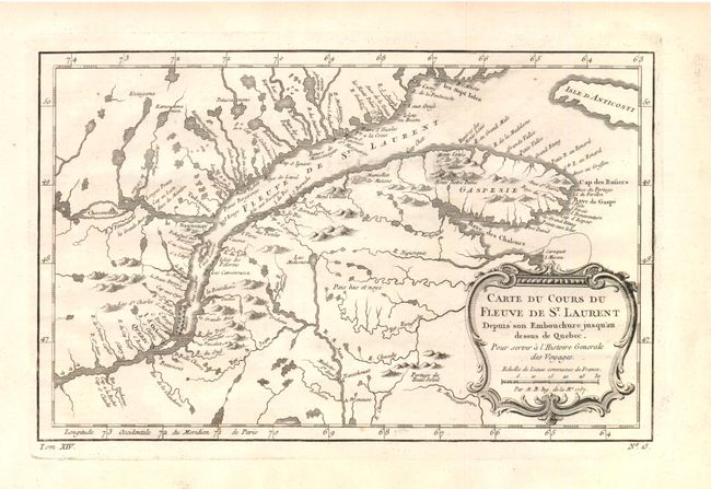
A. Carte du Cours du Fleuve de St. Laurent Depuis son Embouchure Jus qu'au Dessus de Quebec …, (11.8 x 7.5"). Nice example of the first state of this copper engraved map, published by Prevost. The map details the course of the St. Lawrence River from Anticosti Island and the mouth west to beyond Quebec. It details many rocks and shoals in the river with numerous villages and forts located along the shore. Decorated with a rococo-style cartouche that includes a distance scale.
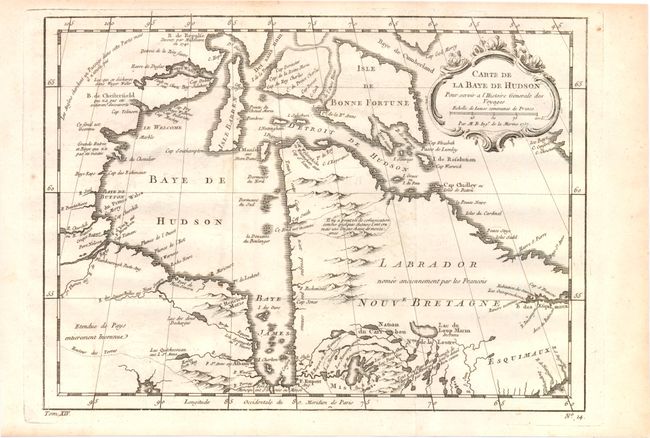
B. Carte de la Baye de Hudson…, (11.8 x 8.6"). Handsome first state example of this chart of the Hudson Bay and Labrador, depicting the mountains and coastal features and including numerous forts. There is a note in French in the far northwest corner of the map explaining that the English had searched for a Northwest Passage in that region, but it did not exist. Embellished with a decorative title cartouche.
References: Kershaw #626, Kershaw #459.
Condition: B+
Both sheets have light offsetting and a few tiny spots, else very good.