Subject: World & America
Period: 1755 (published)
Publication: Discours sur L'Histoire Universelle…
Color: Hand Color
Size:
6.5 x 5 inches
16.5 x 12.7 cm
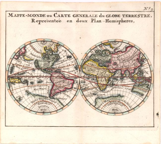
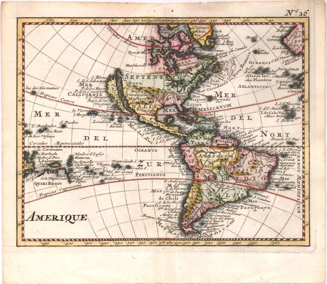
These maps from the uncommon Discours sur L'Histoire Universelle were modeled on Nicolas Sanson's cartography. On the world map, California is shown as an island with the Jesso landmass stretching nearly to Japan. At the South Pole there are still remnants of Terre Magellanique Australe et Incogneue which connects with a partial coastline of New Zealand. New Guinea is shown in approximately its correct position. The Americas map reflects different cartography without the Jesso landmass between North America and Asia or the spurious Southern Continent. Tierra del Fuego is correctly shown as an island and Le Maire Strait is depicted. In the South Pacific, there is a partial coastline labeled Quiri Regio and there is no sign of New Zealand. Both maps show the short-lived New Denmark west of Hudson Bay. The pair presents an interesting comparison of the state of cartographic knowledge in the mid-18th century. Size varies slightly.
References:
Condition: A
Faint stains in blank margins.