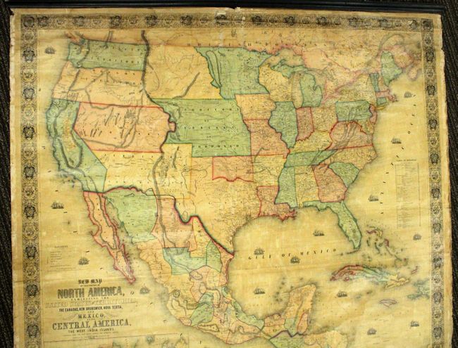
Subject: North America
Period: 1853 (dated)
Publication:
Color: Hand Color
Size:
59 x 56 inches
149.9 x 142.2 cm
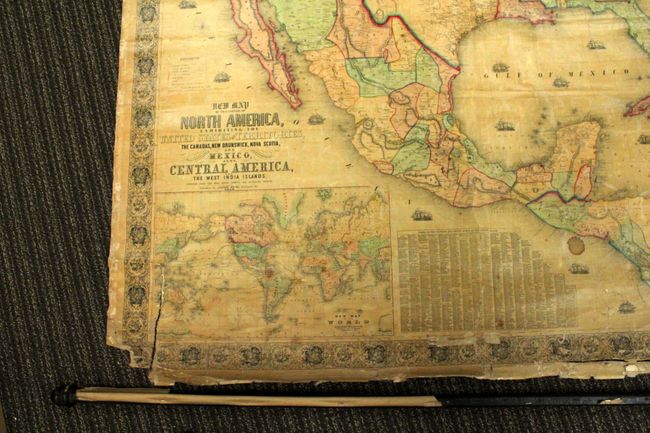
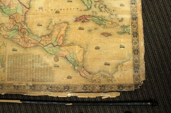
This majestic wall map was published just as the country was beginning to expand fully to the Pacific following the land gains after the Mexican-American War. The gold region in California is named, but is remarkably inaccurate with Auburn shown well north of Sacramento City and lying between it and the Marysville & Yuba City area. The Great Basin area is also inaccurate and roughly follows the Fremont model. The map is filled with wagon routes, explorer's trails, forts, and Indian tribes. Much of the middle portion of the United Sates is organized into the Proposed Territory of Nebraska with the northern plains completely unorganized, and the new Indian Territory that is delineated but not named. Minnesota includes portions of Dakota, which is not named. Further west, only California and the territories of Oregon, Washington, Utah and New Mexico exist (with a Pre-Gadsden border). The map includes a table of distances and a table of counties and towns with more than 1,200 names. There is also a large inset of the World on Mercator's projection. This is a very handsome wall map with decorative borders and numerous engraved sailing and steam/sail ships in the oceans. Complete with both original wooden rollers and original linen backing. Published by Hoen & Company.
References: cf. Wheat (TMW) #794; cf. Wheat (GOLD) 243; cf. Rumsey #602.
Condition: C+
There is some small image and paper losses in the upper middle portion of the image and in the bottom corners. There is also a six-inch tear in the lower left portion of the image. The map is lacking the ribbon edging and is attached to the top roller only, but the bottom roller is present. Overall it is in better condition than most large wall maps are found and will require minimal conservation to restore it to its former glory.