Subject: North America
Period: 1772 (dated)
Publication: Encyclopedie: Suite de Recueil des Planches, sur les Sciences…
Color: Black & White
Size:
14.3 x 11.3 inches
36.3 x 28.7 cm
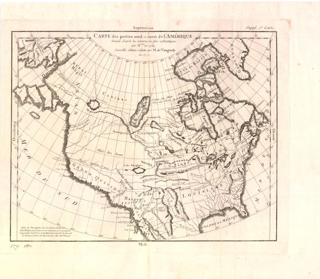
Robert de Vaugondy's rendition of Samuel Engel's map of 1764 alters the North American coastline slightly and extends to include part of Asia. The myth of a Northwest Passage continues to persist, here linking the Detroit d Anian with Lac Michinipi by a system of rivers and a large Lac des Conibas. There is also a River of the West that connects to another large lake, L. des Tahuglanuks that is located near a remnant of Lanhotan's R. Longue. Alaska is shown as a series of large islands. California is labeled Grand Quivira. A great map that illustrates many of the cartographic myths of the period.
References: Pedley #453; Portinaro & Knirsch #155.
Condition: B+
Strong dark impression and text-based watermark, with the plate mark just running off the left edge of the sheet. There are a few minor spots in the blank margin, else very good.