Catalog Archive
Auction 137, Lot 46

"Mappe Monde ou Carte Generale de L'Univers D'Apres Une Projection Nouvelle d'une Sphere Ovale, Pour Mieux Faire Connaitre Les Distances Entre L'Europe at L'Amerique…", Lotter, Mathias Albrecht
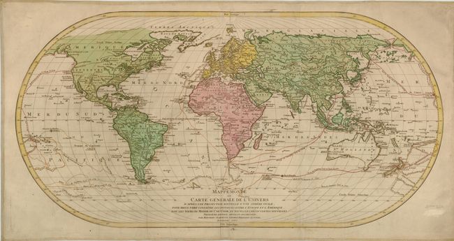
Subject: World

Period: 1787 (dated)

Publication:

Color: Hand Color

Size:
38 x 20 inches
96.5 x 50.8 cm
Download High Resolution Image
(or just click on image to launch the Zoom viewer)

This very large and impressive map on an oval projection is based on D'Anville's wall map of 1761 and was updated to include the recent discoveries of Captain Cook. Published to coincide with the publicity over Cook's circumnavigations, this map is one of the best maps to show Cook's three voyages in great detail. The map features Hawaii, shown here as "O-Why-Hee," which was discovered by Cook in 1779. The explorations of Furneaux and Clarke between 1768-1779 are also depicted. Engraved by George Frederic Lotter. Two sheets joined.

References:

Condition: B+

Original color on watermarked paper. Lightly soiled with a couple of minute worm holes and a minute tear in the center of Africa. Also a crease at bottom center. Backed with old linen, as issued.

Estimate: $1,200 - $1,600

Sold for: $600

Closed on 9/14/2011

Archived