Subject: World
Period: 1761 (dated)
Publication: Nouvel Atlas Portatif
Color: Hand Color
Size:
15.5 x 9.7 inches
39.4 x 24.6 cm
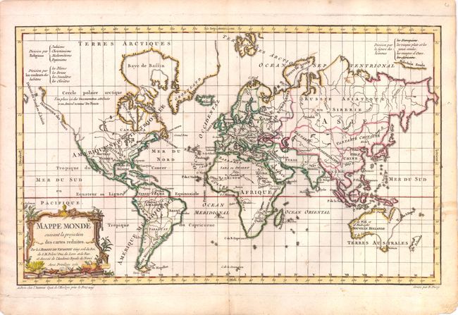
This is the first state of the boldly engraved world map drawn on Mercator's projection. Most of the northwest in North America is blank except for a notation and hint of the possible Northwest Passage and apocryphal discoveries of Admiral de Fonte. The island of Tasmania is connected to Australia and the coastline of eastern Australia is indistinctly drawn, and only the western coast of New Zealand is defined. This interesting map was presented in three thematic versions in the atlas with outline color to show religion, skin color, and "human shape" as given in the legend at top. This version depicts the divisions according to human shape.
References: Pedley #15, McGuirk #106.
Condition: B+
Fine impression with a few insignificant spots and a fold separation at bottom that just enters map image has been professionally repaired. Also a tear in lower-left blank margin has been professionally repaired.