Subject: Pennsylvania
Period: 1852 (dated)
Publication:
Color: Hand Color
Size:
27 x 20.5 inches
68.6 x 52.1 cm
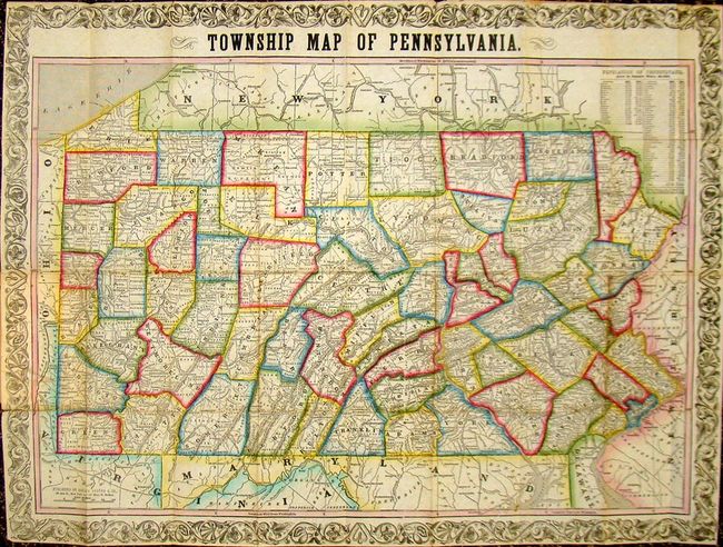
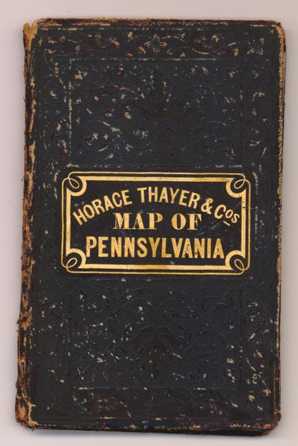
Detailed county map of Pennsylvania showing towns, railroads, watershed and mountains in hachure. Sixty-four counties are listed; the modern counties of Lackawanna, Cameron and Snyder are missing. The "Population of Pennsylvania" table at upper right lists population by county from the 1840 and 1850 census with several counties listed as new in the table. The map is attached to the back cover and folds into original black embossed covers. The original advertising pastedown on the inside front cover lists other maps available from Horace Thayer.
References:
Condition: B+
Beautiful and bright map with some minor foxing primarily in the margins. There are a few clean fold separations that have been repaired with archival material, else very good. Covers show some wear and have archival tape on interior spine.