Subject: Oklahoma
Period: 1898-1909 (dated)
Publication:
Color: Printed Color
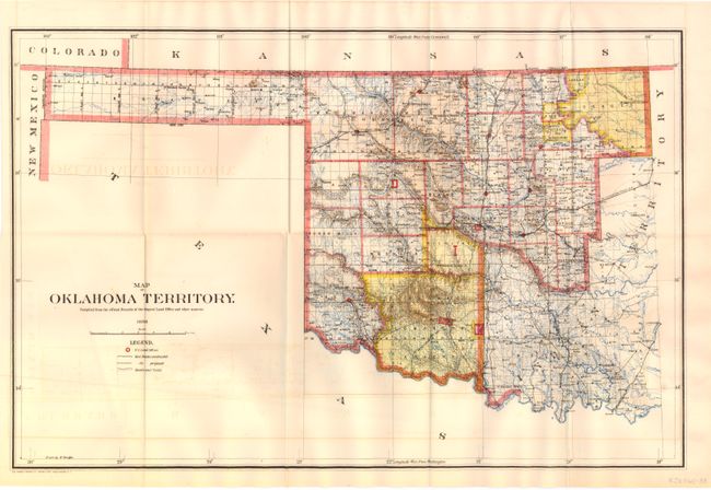
A. Map of Oklahoma Territory, General Land Office, 1898, (21.5" x 14.3"). A good map of the western part of the present state of Oklahoma that also includes a portion of the steadily shrinking Indian Territory. The lands of the Kiowa, Comanche and Apache are depicted in yellow at the bottom; at the top, tribal holdings of the Osage, Ponca, Kansas, Otoe and Missouri are also colored yellow. Army posts are marked in red -- Ft. Sill, Ft. Reno and the Wood Res. Railroads, public roads and trails are identified by symbols shown in the legend. Land Offices are located at Woodward, Alva, Enid, Perry, Guthrie, Kingfisher, Ft. Reno, Oklahoma City, and Mangum. Condition - there is some minor offsetting in the image and some light uniform toning. (B+)
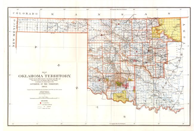
B. Map of Oklahoma Territory, General Land Office, 1903, (22" x 14.5"). An updated version of the 1898 map that shows a contraction of the lands previously held by the Kiowa, Comanche and Apache. Now this area is in county format with small areas designated as grazing lands and reserves. (A+)
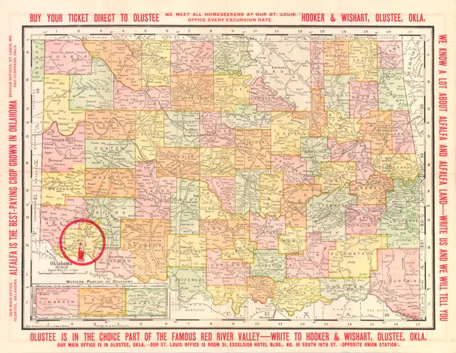
C. Map of Oklahoma, Rand McNally & Co., 1909, (13.8" x 9.5"). Promotional map of Oklahoma, specifically Olustee, to promote alfalfa farming in the area. According to Hooker & Wishart, the issuer, "alfalfa is the best paying crop grown in Oklahoma". Advertisements appear on verso. Condition - small split at fold intersection, else very good. (B+)
References:
Condition:
See descriptions.