Subject: Massachusetts
Period: 1860 (dated)
Publication:
Color: Black & White
Size:
27 x 37 inches
68.6 x 94 cm
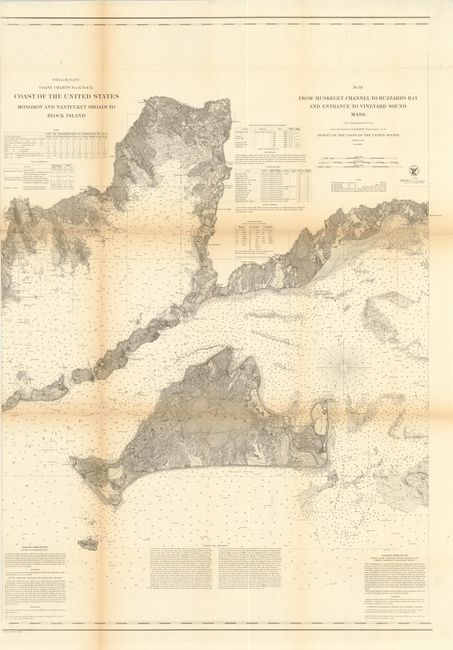
The Office of Coast Survey is the oldest U.S. scientific organization, dating from 1807 when Congress directed that a "survey of the coast" be carried out. By 1836, it was called the U.S. Coast Survey and in 1878, the name was changed to the U.S. Coast and Geodetic Survey. Today the Office of Coast Survey is a division of the National Oceanic and Atmospheric Administration NOAA.
The survey teams, composed of civilians as well as Army and Naval officers, charted the nation's waterways and produced a wide array of reports, survey charts, hydrographic studies of tides and currents, astronomical studies and observations, and coastal pilots. These charts are an important record of the changing nature of the nation's coastlines. In additional to coastal charts, the U.S. Coast and Geodetic Survey produced land sketches, Civil War battle maps, and the early aeronautical charts.
This early chart provides a detailed examination of Martha's Vineyard. Filled with sailing directions, dangers in the area, information on tides, winds, currents, and incredible inland detail. There is also a table detailing the location, height, and distance visible from sea for each light house. This is the middle sheet of a three sheet set titled "Coast of the United States. Monomoy and Nantucket Shoals to Block Island..." which appears on this sheet.
References:
Condition: B
A few splits at fold intersections and a small fold separation on left just entering the image. Mild toning along the folds with left margin trimmed to neatline.