Subject: Western Hemisphere
Period: 1823 (dated)
Publication: National Atlas
Color: Hand Color
Size:
16.5 x 13 inches
41.9 x 33 cm
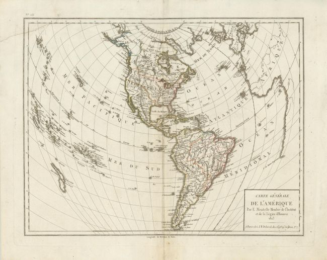
The United States and Great Britain established in 1818 joint claim over the Oregon Territory - the region north of Spanish controlled Upper California up to the southern boundary of Russia's Alaska Territory at North latitude 54°40'. By the late 1830's this arrangement was beginning to fall apart.
In the 1840's the expansionist Democrats, including their 1844 presidential candidate, James Polk, claimed the entire region for the United States. Their expansionist desires were expressed by Polk's famous campaign slogan, "Fifty-four Forty or Fight!" The slogan also became a rally cry for Americans desiring to settle the territory. Following Polk's election, the dispute was resolved by the 1846 Treaty of Oregon, which struck a compromise that fixed the U.S./Canadian boundary at 49º North.
Presented on a unique projection that provides an almost 3-D effect, this map of the Americas extends to show the curvature of the earth. This edition shows the United States extending to the Pacific in the Northwest, labeled Columbia, and extending well into present-day Canada. In the United States the states are not shown, but many cities and towns are located including S. Antonio, Santa Fe, Taos, St. Louis and New Madrid. Published by J.B. Delaval, Rue Geoffroy Langevin, No. 7, Paris.
References:
Condition: B+
With some professionally accomplished repairs along centerfold and to close a tear across upper left corner.