Subject: India
Period: 1511 (published)
Publication: Claudii Ptholemaei Alexandrini liber geographiae cum tabulis…
Color: Black & White
Size:
20 x 15.2 inches
50.8 x 38.6 cm
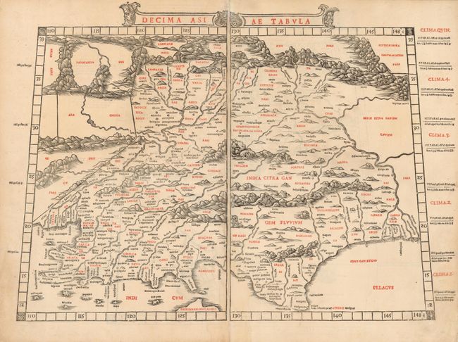
This is an extremely early example of 16th century Venetian cartography and one of the earliest maps of India obtainable by today's collectors. Sylvanus was among the first cartographers to attempt the updating of Ptolemy's work, and this map is a remarkable view of the region between the deltas of the Indus and Ganges Rivers. It presents the region with undulating mountains, bold rivers and numerous place names. Following Ptolemy's outline, southern India is severely truncated and the northern tip of Taprobana appears incorrectly to the west of the subcontinent.
Sylvanus' edition of Ptolemy's Geographia is the earliest known example of two-color printing for maps. It included 28 woodcut maps, each printed from two separate unique blocks. They were printed in such a way that the left-hand side of each map was printed on the verso of the right-hand side of the preceding map. Thus complete maps all are now joined from two sheets with two unrelated half maps on the verso. All Sylvanus maps are very rare in today's market.
References: Mickwitz & Miekkavaara (Nordenskiold) #204-25.
Condition: A
Very minor toning in margins and along the central joint.