Subject: World
Period: 1809 (published)
Publication: Nouvel atlas de la Bible…
Color: Hand Color
Size:
18.2 x 15.5 inches
46.2 x 39.4 cm
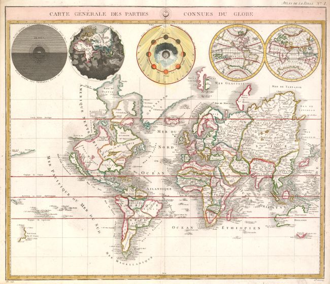
This is a very uncommon version of Pierre Mortier's unique world map published by Jacques Desray. California is shown as an island and the Detroit d'Anian connects by dotted lines through the Northwest Passage to Button's Bay, which is located to the west of Hudson Bay. In North America there is an erroneous large lake shown as the source for the Rio Norte, which flows southwest and empties into the Gulf of California. In the Great Lakes region is a large open-ended lake named Mer Douce. The northeast coast of Asia is severely truncated and shows Witsen's Cap de Glaces. A small coastline of New Zealand appears in the Pacific. Australia's northern coast is shown connected to New Guinea, and two disjointed coastlines appear to the south including Van Diemen's Land. The most interesting features of the map are the five spheres presented along the top. These depict Day and Night, the Flood, the phases of the moon, and the Western and Eastern Hemispheres. The map was precisely engraved by Mademoiselle Glot.
References: cf Shirley #622.
Condition: A
There is a hint of soil and faint foxing, still overall very good.