Subject: World
Period: 1778 (dated)
Publication:
Color: Hand Color
Size:
15.5 x 9.5 inches
39.4 x 24.1 cm
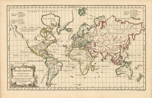
This boldly engraved world map is drawn on Mercator's projection. Most of the northwest in North America is blank except for a notation and hint of the possible Northwest Passage and apocryphal discoveries of Admiral de Fonte. The island of Tasmania is connected to Australia and the coastline of southeastern Australia is indistinctly drawn, but Cook's discoveries along the eastern coast are shown, and New Zealand appears as two distinctive islands. Tahiti appears within the decorative title cartouche. The first state of this map (1761) was presented in three thematic versions in the atlas with coloring to show religion, skin color, and "human shape" as given in the legend at top. In this uncommon second state, the color indicates the continental and political boundaries, the map was updated with the recent discoveries, and "et Censeur Royal" was added to the imprint in the cartouche.
References: Pedley #15.
Condition: A
Very nice example.